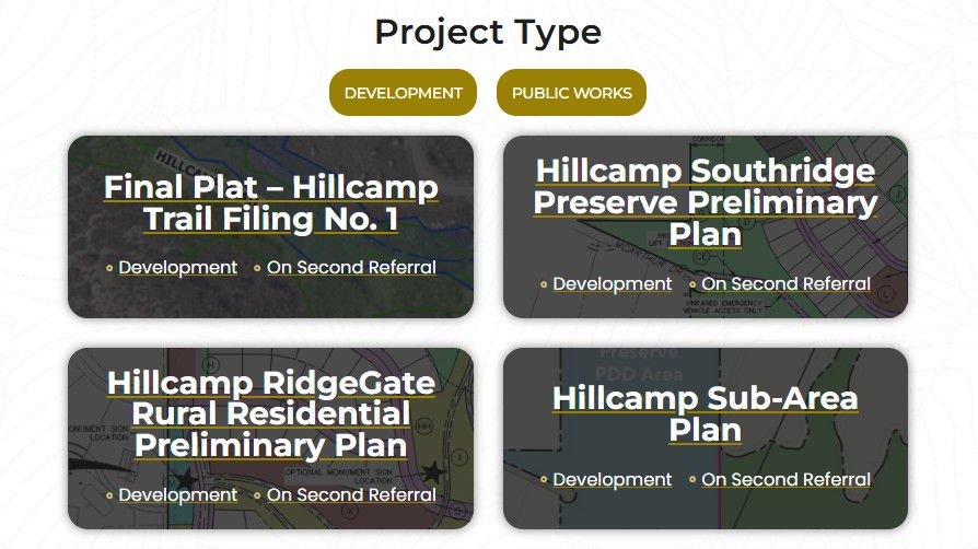
Hillcamp Drive: A Dangerous Plan Built on Unstable Ground
- Save the Lone Tree Bluffs

- Nov 11, 2025
- 5 min read
Updated: Nov 13, 2025
You don't need an engineering degree to understand that the Hillcamp Drive and pedestrian bridge proposal appears fundamentally flawed.
A Risky Road That Requires Public and Private Land
To reach their proposed 343-home Hillcamp subdivision, developers hope to extend Cabela Drive south from RidgeGate Parkway, creating what would become Hillcamp Drive—the only access road to the entire project. Both Surrey Ridge and McArthur Ranch neighbors are fighting any connections through their rural communities.
The catch? This road can’t exist without cutting through City-owned public land and privately held property from a nearby neighborhood. It would slice into steep bluffs and climb the mesa tops through some of the most geologically fragile terrain in Lone Tree.
Plans also call for a 10-foot-wide by 120-foot-long pedestrian bridge anchored into the same unstable hillsides. And when the road or bridge start cracking or eroding—as the engineers themselves acknowledge they most certainly will— Brookfield Residential and RidgeGate Investments won't be footing the bill.
Instead, the developer-controlled Rampart Range Metropolitan District plans to hand the road to the City of Lone Tree and the bridge to Douglas County, leaving taxpayers responsible for long-term maintenance.
Built on Risk from the Start
According to one geotechnical report, the site contains steep slopes, expansive claystone bedrock, and active drainage channels. The report goes on to warn that “the presence of expansive soils and bedrock and steep slopes constitutes a geologic hazard,” and that there’s “risk that improvements will heave or settle and be damaged,” even if all recommended mitigations are applied.
It also found groundwater as shallow as 22 feet — groundwater that can rise after heavy storms or with new development. Anyone who’s ever seen runoff in this canyon after a summer rain knows: once this soil gets saturated, it moves.
Landslides Have Already Happened Nearby
The Preliminary Geotechnical and Slope Stability Evaluation report from April 25 of this year confirms that landslides have already occurred northeast and northwest of the project area, stating bluntly:
“There is a risk of landslides within the subject site.”
And these aren’t relics from a century ago — fresh slope movement was documented within the last 18 months just west of the proposed roadway and northeast of the bridge. If over 15 feet of movement occurred from a pipe break in this hillside, what will occur after a half-mile long road with giant retaining walls and a 120-foot long pedestrian bridge goes in?
The same unstable Dawson Arkose and Castle Rock Conglomerate formations responsible for those slides lie directly beneath Hillcamp Drive’s proposed alignment.
You don’t need a geology degree to see the problem here. This land is already sliding — and the plan is to put a major road and bridge right on top of it.
Expansive, Shifting Soils
The reports also describe layers of expansive clay and claystone — soils that swell when wet and shrink when dry. These are the exact conditions that cause cracking pavement, warped retaining walls, and shifting bridge decks.
Claystone samples showed up to 2.4 percent swell potential, and the engineers noted “complications for pier installation may include groundwater and lenses of very hard bedrock,” making deep foundations unpredictable and difficult to construct.
When the paid consultants themselves are warning of “complications,” “hazards,” and “risks of damage,” it’s hard to believe anyone would think this is a safe place for public infrastructure.
Erosion, Drainage, and Soil Instability
Three different drainage and soil reports all reach the same conclusion: this land was never meant to handle a major road and bridge.
More than 52 percent of the site is classified as “Hilly Gravelly Land – Hydrologic Group D,” meaning poor infiltration and very high runoff. These slopes don’t absorb water — they shed it, which accelerates erosion and destabilizes everything below.
The Hillcamp drainage report goes even further, confirming that the ravine and hillside where the road and bridge are proposed are active drainageways — literally part of the Cottonwood Creek watershed.
“Cottonwood Creek begins just north of the existing northern property line … Flows are conveyed down the existing slopes until they channelize in the steep drainageways … and ultimately into Cottonwood Creek.”— Hillcamp Drainage Report – 3rd Revision (2025)
Translation: they’re proposing to pave a road in the middle of a natural storm-drain channel that feeds one of the city’s main creeks.
The bridge report also warns of erosion and scour hazards that could undermine foundations unless water is “rapidly removed away from structures.” On this terrain, “rapid removal” just means funneling even more water downhill toward the Cottonwood Creek and nearby neighborhoods.
Even an untrained reader can see how reckless that is. You don’t build a bridge in a drainageway and call it good planning.
Ignoring Safer Alternatives
Despite every red flag, Brookfield Residential and RidgeGate Investments remain laser-focused on this fragile corridor. They’ve refused to seriously consider land east of Hillcamp near I-25, where a former cattle road already exists and the land is far less fragile.
And remember — all of these reports were written by engineers hired and paid by the developers. If their own consultants are this worried, imagine what an independent review will show once this project finally faces public scrutiny in the Public Referral Process.
Passing the Buck
After construction, Rampart Range Metro District plans to turn the road over to Lone Tree and the bridge to Douglas County. That means taxpayers will inherit the long-term maintenance, repair costs, and liability for infrastructure their own experts describe as risky.
If (or when) a landslide or structural failure occurs, who’s responsible — the developers, the City, or the public who warned it wasn’t safe?
A Clear Warning for Lone Tree
The extension of Cabela Drive into Hillcamp Drive — and the massive pedestrian bridge crossing a ravine — isn’t just questionable planning; it’s a safety hazard and financial trap.
The developers’ own studies describe steep slopes, active drainageways, expansive soils, and known landslide risk — yet the plan keeps moving forward, shifting the danger and the bill onto the community.
This isn’t about being anti-growth. It’s about demanding accountability, transparency, and common sense before the bluffs — and our city’s credibility — give way.
“We judge that the presence of expansive soils and bedrock and steep slopes constitutes a geologic hazard.”— CTL | Thompson, RidgeGate Mesa Tops Bridge Geotechnical Investigation (2025)
What You Can Do
Share this page with your neighbors.
Sign up for Lone Tree's development notifications so your written comments are included during the public referral period. Demand the City require more independent, third-party geotechnical and drainage reviews before any applications can move to public meetings.
Read the development documents found under the link on the main homepage.
The Facts in Their Own Words
Risk Category | What the Reports Say | Source |
Landslides | “There is a risk of landslides within the subject site.” | Slope Stability Evaluation (CTL Thompson, Apr 2025) |
Steep Slopes / Geologic Hazard | “The presence of expansive soils and bedrock and steep slopes constitutes a geologic hazard.” | Bridge Geotechnical Investigation (Jul 2025) |
Groundwater | Found 22–42 ft below surface; may rise with rainfall or development | Bridge Geotechnical Investigation (Jul 2025) |
Expansive Soils | Claystone samples swelled up to 2.4 % | Slope Stability Evaluation (Apr 2025) |
Drainage / Erosion Risk | 52 % of site rated “Group D – poor drainage” | NRCS Soil Survey (2024) |


Comments